Lake Preston, South Dakota
Lake Preston, South Dakota
Jump to navigation
Jump to search
Lake Preston, South Dakota | |
|---|---|
City | |
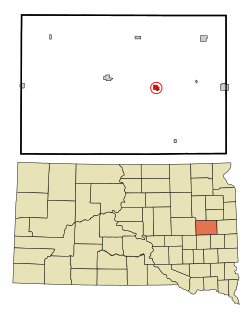 Location in Kingsbury County and the state of South Dakota | |
| Coordinates: 44°21′46″N 97°22′30″W / 44.36278°N 97.37500°W / 44.36278; -97.37500Coordinates: 44°21′46″N 97°22′30″W / 44.36278°N 97.37500°W / 44.36278; -97.37500 | |
| Country | United States |
| State | South Dakota |
| County | Kingsbury |
| Incorporated | 1906[1] |
| Area [2] | |
| • Total | 0.76 sq mi (1.97 km2) |
| • Land | 0.76 sq mi (1.97 km2) |
| • Water | 0 sq mi (0 km2) |
| Elevation | 1,722 ft (525 m) |
| Population (2010)[3] | |
| • Total | 599 |
| • Estimate (2015)[4] | 568 |
| • Density | 788.2/sq mi (304.3/km2) |
| Time zone | UTC-6 (Central (CST)) |
| • Summer (DST) | UTC-5 (CDT) |
| ZIP codes | 57233, 57249 |
| Area code(s) | 605 |
| FIPS code | 46-35500[5] |
GNIS feature ID | 1265274[6] |
Lake Preston is a city in Kingsbury County, South Dakota, United States. The population was 599 at the 2010 census.
Contents
1 History
2 Geography
3 Demographics
3.1 2010 census
3.2 2000 census
4 In the media
5 Notable people
6 See also
7 References
History[edit]
A post office called Preston was established in 1879, and the name was changed to Lake Preston in 1882.[7] The town site was platted in 1881.[8] It was located in the Dakota Territory at the time. The city took its name from nearby Lake Preston.[9]
Geography[edit]
Lake Preston is located at 44°21′46″N 97°22′30″W / 44.36278°N 97.37500°W / 44.36278; -97.37500 (44.362848, -97.374872).[10]
According to the United States Census Bureau, the city has a total area of 0.76 square miles (1.97 km2), all of it land.[2]
Lake Preston has been assigned the ZIP code 57249 and the FIPS place code 35500.
Demographics[edit]
| Historical population | |||
|---|---|---|---|
| Census | Pop. | %± | |
| 1890 | 337 | — | |
| 1900 | 706 | 109.5% | |
| 1910 | 1,007 | 42.6% | |
| 1920 | 1,008 | 0.1% | |
| 1930 | 944 | −6.3% | |
| 1940 | 886 | −6.1% | |
| 1950 | 957 | 8.0% | |
| 1960 | 955 | −0.2% | |
| 1970 | 812 | −15.0% | |
| 1980 | 789 | −2.8% | |
| 1990 | 663 | −16.0% | |
| 2000 | 737 | 11.2% | |
| 2010 | 599 | −18.7% | |
| Est. 2016 | 565 | [11] | −5.7% |
| U.S. Decennial Census[12] 2015 Estimate[4] | |||
2010 census[edit]
As of the census[3] of 2010, there were 599 people, 295 households, and 162 families residing in the city. The population density was 788.2 inhabitants per square mile (304.3/km2). There were 346 housing units at an average density of 455.3 per square mile (175.8/km2). The racial makeup of the city was 98.3% White, 0.3% Native American, 0.2% Asian, 0.5% from other races, and 0.7% from two or more races. Hispanic or Latino of any race were 1.2% of the population.
There were 295 households of which 20.0% had children under the age of 18 living with them, 46.8% were married couples living together, 5.8% had a female householder with no husband present, 2.4% had a male householder with no wife present, and 45.1% were non-families. 40.7% of all households were made up of individuals and 19.7% had someone living alone who was 65 years of age or older. The average household size was 2.03 and the average family size was 2.77.
The median age in the city was 47.6 years. 20.2% of residents were under the age of 18; 5.5% were between the ages of 18 and 24; 17.8% were from 25 to 44; 34.5% were from 45 to 64; and 21.9% were 65 years of age or older. The gender makeup of the city was 50.9% male and 49.1% female.
2000 census[edit]
As of the census[5] of 2000, there were 737 people, 317 households, and 183 families residing in the city. The population density was 999.0 people per square mile (384.5/km²). There were 355 housing units at an average density of 481.2 per square mile (185.2/km²). The racial makeup of the city was 98.91% White, 0.81% Native American, and 0.27% from two or more races. Hispanic or Latino of any race were 0.95% of the population.
There were 317 households out of which 26.5% had children under the age of 18 living with them, 50.2% were married couples living together, 5.4% had a female householder with no husband present, and 42.0% were non-families. 38.8% of all households were made up of individuals and 23.3% had someone living alone who was 65 years of age or older. The average household size was 2.15 and the average family size was 2.88.
In the city, the population was spread out with 22.7% under the age of 18, 5.6% from 18 to 24, 23.5% from 25 to 44, 19.0% from 45 to 64, and 29.3% who were 65 years of age or older. The median age was 43 years. For every 100 females, there were 94.5 males. For every 100 females age 18 and over, there were 89.4 males.
The median income for a household in the city was $29,125, and the median income for a family was $42,143. Males had a median income of $29,750 versus $18,750 for females. The per capita income for the city was $16,426. About 6.5% of families and 8.1% of the population were below the poverty line, including 6.6% of those under age 18 and 15.0% of those age 65 or over.
In the media[edit]
Lake Preston is mentioned in the historical novel The Long Winter
by American novelist Laura Ingalls Wilder. In the very severe winter of 1880-1881, a neighbor of Ingalls, David Gilbert, volunteered to make the very risky run from De Smet, South Dakota to Lake Preston (called, at that time, simply "Preston, Dakota Territory")
to take outgoing mail and bring back the incoming mail. Though the distance was only about 12 miles,[13] the trip was dangerous because of blizzards coming up very quickly throughout that winter, and a person caught on the prairie during a blizzard had almost no chance of survival.
Notable people[edit]
Ora McMurry,[14]Distinguished Service Cross, World War I
Robert Wood,[15]Wisconsin State Assembly
See also[edit]
- Lake Preston (South Dakota)
References[edit]
^ "SD Towns" (PDF). South Dakota State Historical Society. Archived from the original (PDF) on 2010-02-10. Retrieved 2010-02-14..mw-parser-output cite.citation{font-style:inherit}.mw-parser-output q{quotes:"""""""'""'"}.mw-parser-output code.cs1-code{color:inherit;background:inherit;border:inherit;padding:inherit}.mw-parser-output .cs1-lock-free a{background:url("//upload.wikimedia.org/wikipedia/commons/thumb/6/65/Lock-green.svg/9px-Lock-green.svg.png")no-repeat;background-position:right .1em center}.mw-parser-output .cs1-lock-limited a,.mw-parser-output .cs1-lock-registration a{background:url("//upload.wikimedia.org/wikipedia/commons/thumb/d/d6/Lock-gray-alt-2.svg/9px-Lock-gray-alt-2.svg.png")no-repeat;background-position:right .1em center}.mw-parser-output .cs1-lock-subscription a{background:url("//upload.wikimedia.org/wikipedia/commons/thumb/a/aa/Lock-red-alt-2.svg/9px-Lock-red-alt-2.svg.png")no-repeat;background-position:right .1em center}.mw-parser-output .cs1-subscription,.mw-parser-output .cs1-registration{color:#555}.mw-parser-output .cs1-subscription span,.mw-parser-output .cs1-registration span{border-bottom:1px dotted;cursor:help}.mw-parser-output .cs1-hidden-error{display:none;font-size:100%}.mw-parser-output .cs1-visible-error{font-size:100%}.mw-parser-output .cs1-subscription,.mw-parser-output .cs1-registration,.mw-parser-output .cs1-format{font-size:95%}.mw-parser-output .cs1-kern-left,.mw-parser-output .cs1-kern-wl-left{padding-left:0.2em}.mw-parser-output .cs1-kern-right,.mw-parser-output .cs1-kern-wl-right{padding-right:0.2em}
^ ab "US Gazetteer files 2010". United States Census Bureau. Archived from the original on 2012-07-14. Retrieved 2012-06-21.
^ ab "American FactFinder". United States Census Bureau. Retrieved 2012-06-21.
^ ab "Population Estimates". United States Census Bureau. Archived from the original on October 19, 2016. Retrieved June 13, 2016.
^ ab "American FactFinder". United States Census Bureau. Retrieved 2008-01-31.
^ "US Board on Geographic Names". United States Geological Survey. 2007-10-25. Retrieved 2008-01-31.
^ "Kingsbury County". Jim Forte Postal History. Retrieved 21 March 2015.
^ Federal Writers' Project (1940). South Dakota place-names, v.1-3. University of South Dakota. p. 47.
^ Chicago and North Western Railway Company (1908). A History of the Origin of the Place Names Connected with the Chicago & North Western and Chicago, St. Paul, Minneapolis & Omaha Railways. p. 92.
^ "US Gazetteer files: 2010, 2000, and 1990". United States Census Bureau. 2011-02-12. Retrieved 2011-04-23.
^ "Population and Housing Unit Estimates". Retrieved June 9, 2017.
^ United States Census Bureau. "Census of Population and Housing". Retrieved June 13, 2016.
^ Wilder, Laura Ingalls. The Long Winter. Mustbe Interactive. p. 148.
^ "Ora R. McMurry : Place of Birth: South Dakota, Lake Preston : Home of record: Evansville Wisconsin". Militarytimes.com. Retrieved 14 January 2015.Lieutenant McMurry was credited with 3 aerial victories in World War I
^ "Biographical: U. S. senators, state officers, supreme court judges, state senators, members of assembly". University of Wisconsin Digital Collections. Retrieved 2015-12-04.
Municipalities and communities of Kingsbury County, South Dakota, United States | ||
|---|---|---|
County seat: De Smet | ||
| Cities |
|  |
| Towns |
| |
| Unincorporated communities |
| |
| Ghost town |
| |
| Footnotes | ‡This populated place also has portions in an adjacent county or counties | |
Categories:
- Cities in South Dakota
- Cities in Kingsbury County, South Dakota
- 1879 establishments in Dakota Territory
(window.RLQ=window.RLQ||).push(function(){mw.config.set({"wgPageParseReport":{"limitreport":{"cputime":"0.468","walltime":"0.575","ppvisitednodes":{"value":4663,"limit":1000000},"ppgeneratednodes":{"value":0,"limit":1500000},"postexpandincludesize":{"value":73118,"limit":2097152},"templateargumentsize":{"value":8250,"limit":2097152},"expansiondepth":{"value":14,"limit":40},"expensivefunctioncount":{"value":0,"limit":500},"unstrip-depth":{"value":1,"limit":20},"unstrip-size":{"value":39784,"limit":5000000},"entityaccesscount":{"value":1,"limit":400},"timingprofile":["100.00% 502.006 1 -total"," 56.33% 282.762 1 Template:Infobox_settlement"," 30.32% 152.207 1 Template:Infobox"," 25.02% 125.617 1 Template:Reflist"," 18.80% 94.370 12 Template:Cite_web"," 11.08% 55.604 1 Template:Short_description"," 7.76% 38.943 2 Template:Coord"," 6.66% 33.451 1 Template:US_Census_population"," 6.51% 32.705 3 Template:Convert"," 3.68% 18.494 1 Template:Kingsbury_County,_South_Dakota"]},"scribunto":{"limitreport-timeusage":{"value":"0.201","limit":"10.000"},"limitreport-memusage":{"value":6916120,"limit":52428800}},"cachereport":{"origin":"mw1262","timestamp":"20181225021123","ttl":1900800,"transientcontent":false}}});});{"@context":"https://schema.org","@type":"Article","name":"Lake Preston, South Dakota","url":"https://en.wikipedia.org/wiki/Lake_Preston,_South_Dakota","sameAs":"http://www.wikidata.org/entity/Q2549228","mainEntity":"http://www.wikidata.org/entity/Q2549228","author":{"@type":"Organization","name":"Contributors to Wikimedia projects"},"publisher":{"@type":"Organization","name":"Wikimedia Foundation, Inc.","logo":{"@type":"ImageObject","url":"https://www.wikimedia.org/static/images/wmf-hor-googpub.png"}},"datePublished":"2002-10-25T06:56:17Z","dateModified":"2018-05-12T00:34:08Z","image":"https://upload.wikimedia.org/wikipedia/commons/a/a1/Kingsbury_County_South_Dakota_Incorporated_and_Unincorporated_areas_Lake_Preston_Highlighted.svg"}(window.RLQ=window.RLQ||).push(function(){mw.config.set({"wgBackendResponseTime":92,"wgHostname":"mw1248"});});


